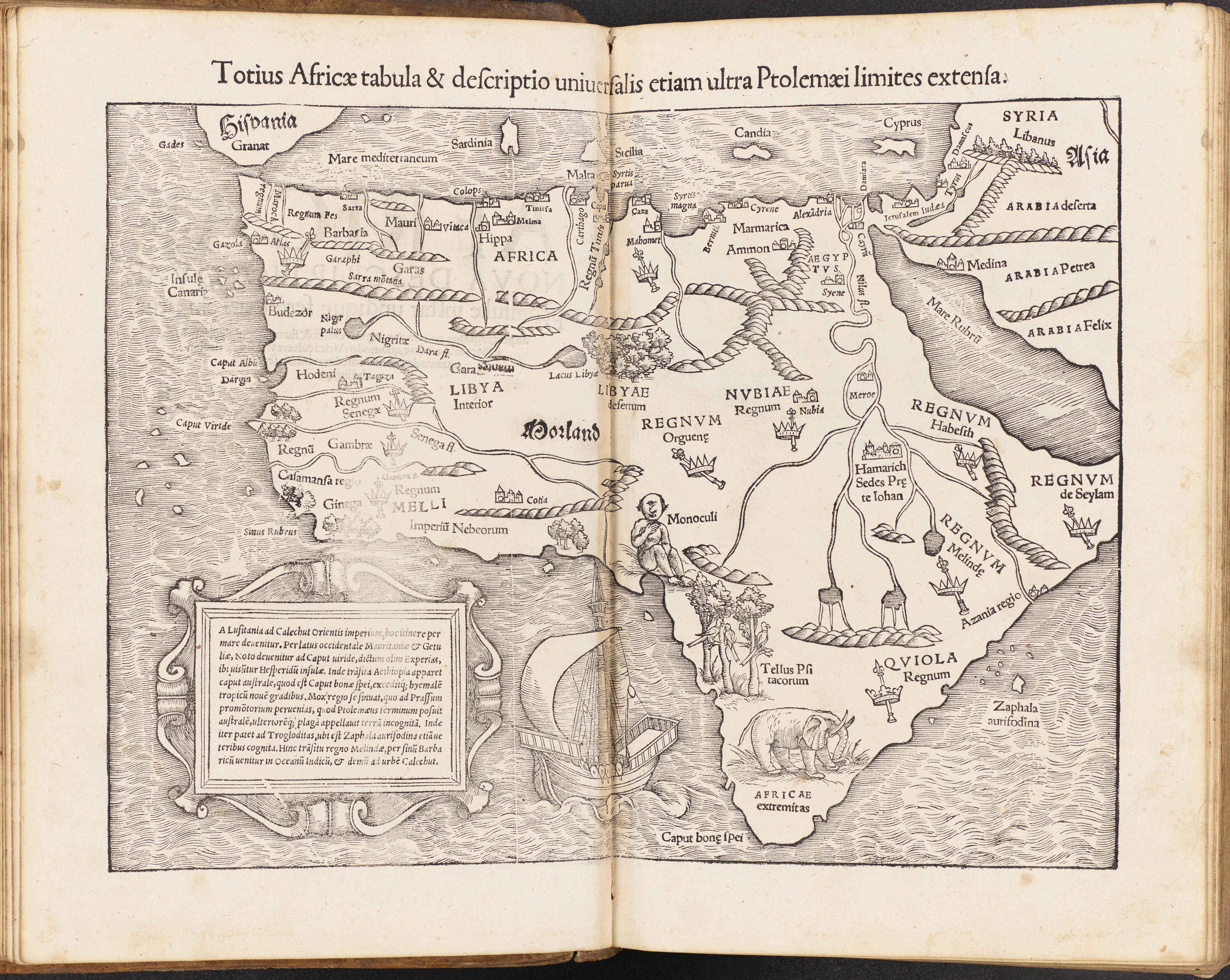
Title: ‘Map of the whole of Africa based on Ptolemaic sources (Totius Africӕ tabula, & descriptio universalis, etiam ultra Ptolemӕi limites extensa),’ in Sebastian Münster, Cosmography, book 6 (Cosmographiae universalis lib. VI), plate 13.
Place: Published in Basel by Heinrich Petri
Date: 1552
Medium & technique: Woodcut on paper
Dimensions: 300 x 400 mm
Themes: Global – Local / Monstrous – Marvellous
Collection: The John Rylands Library, (c) The University of Manchester
In this map, Sebastian Münster (1488–1552) extends the boundaries of Claudius Ptolemy’s (d. 160) classical world to create what is generally considered the first printed map of the African continent. He pictures the European ‘discovery’ of African lands beyond the equator, which were thought to be inaccessible due to the extremely hot climate of the torrid zone. A one-eyed figure, representing the monstrous tribe of cave-dwelling, cannibalistic giants, called the Monoculi, looms large in the centre. While Münster exaggerated the size of Monoculus’s body and eye to emphasize its ‘unnatural’ features, most of its physical characteristics appear to be human. This blurring of human and non-human features is exemplary of the way early modern Europeans constructed ethnographic knowledge of faraway peoples and grappled with human diversity in the wake of exploration. Münster situates this foreign body at the border of Ptolemy’s ancient world, a distant place between the known and unknown, where viewers are called to use their imagination. Read more about this object.
Danielle Gravon, University of Manchester
Further Reading:
Surekha Davies, Renaissance Ethnography and the Invention of the Human: New Worlds, Maps and Monsters (Cambridge: Cambridge University Press, 2017).
Valerie I.J. Flint, ‘Monsters and the Antipodes in the Early Middle Ages and Enlightenment,’ Viator 15 (1984), 65-80.
David Woodward, ed., The History of Cartography: Cartography of the European Renaissance, Volume 3, Parts 1 and 2 (Chicago: University of Chicago Press, 2007).