Title: Borgia World Map (Borgia Mappa Mundi)
Place: Possibly southern Germany
Date: Fifteenth century
Medium & technique: Engraving on paper
Dimensions: 646 mm diameter
Themes: Global – Local / Monstrous – Marvellous
Collection: The John Rylands Library, (c) The University of Manchester
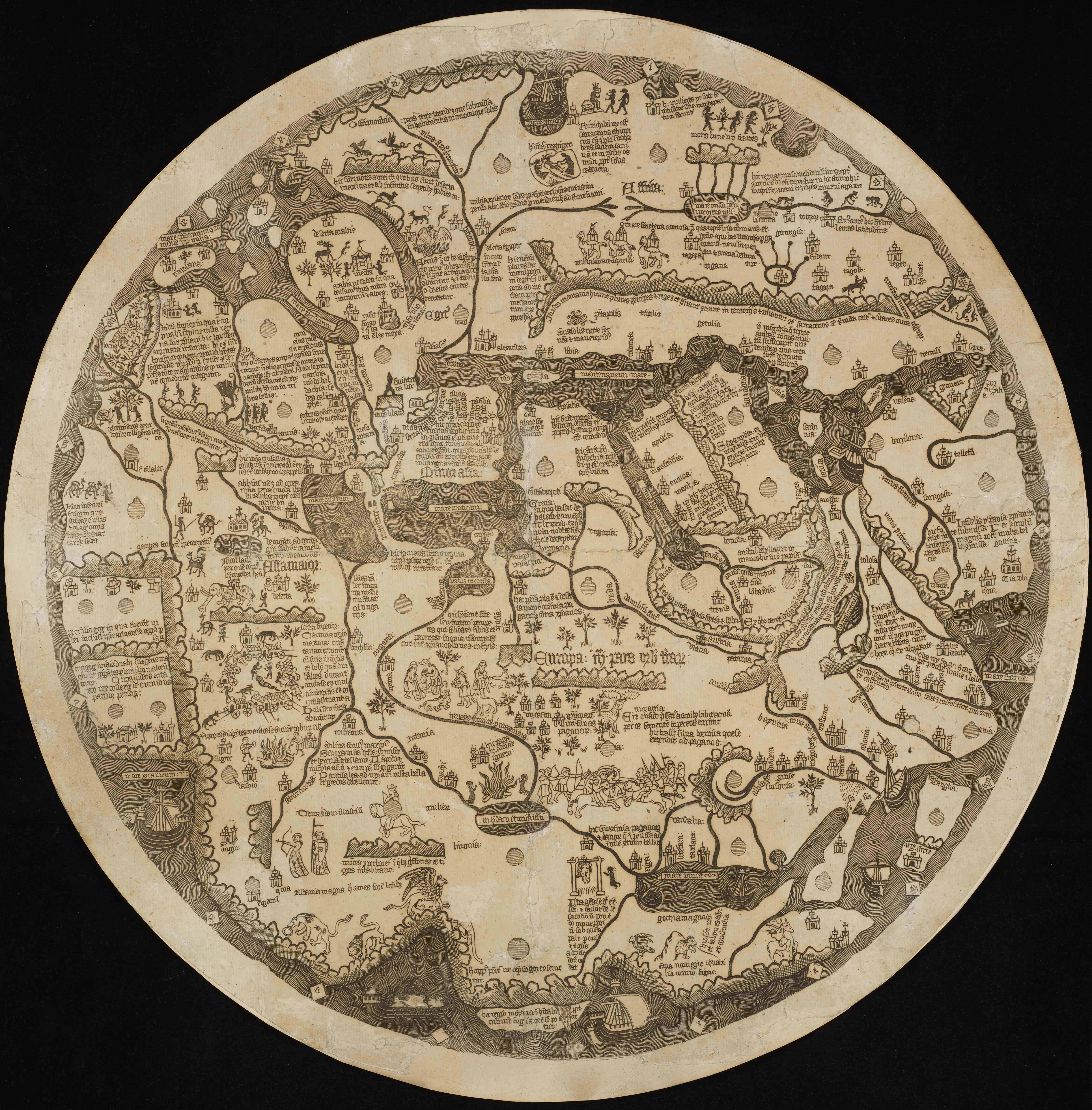
The elaborate Borgia Mappa Mundi, or map of the world, pictures multiple layers of ‘foreignness’ – exotic animals, hybrid creatures, distant nations, fabled races, and non-Christian peoples – across the lands of Africa at the top, Asia to the left, and Europe in the centre and bottom. At the very top, silhouettes of dog-headed figures, representing the ‘Saracen Ethiopian King with his dog-headed people’, are found next to a tribe of hairy Ethiopian women, slightly to the right. On the left side of the Borgia map, in India, three devilish figures and a dragon dance near the gates of Paradise, where two figures protect an angel. Just below this, in the two square regions of Gog and Magog, is the dwelling place of the Jewish people, whom the map describes as giants with ‘evil manners’. In Prussia, placed centrally at the bottom of the map, a battle wages between the Christians and Pagans, who are ‘continually fighting with one another’. Read more about this object.
Danielle Gravon, University of Manchester
Further Reading:
Evelyn Edson, The World Map, 1300–1492: The Persistence of Tradition and Transformation (Baltimore: The Johns Hopkins University Press, 2007).
Wilma George, Animals and Maps (Berkeley: University of California Press, 1969).
Andrew Gow, ‘Gog and Magog on Mappaemundi and Early Printed World Maps: Orientalising Ethnography in the Apocalyptic Tradition,’ Journal of Early Modern History 2/1 (1998), 61-88.
A.E. Nordenskiöld, An Account of a Copy from the 15th Century Map of the World Engraved on Metal which is Preserved in Cardinal Stephan Borgia’s Museum at Velletri (Stockholm: A.L. Norman, 1891).