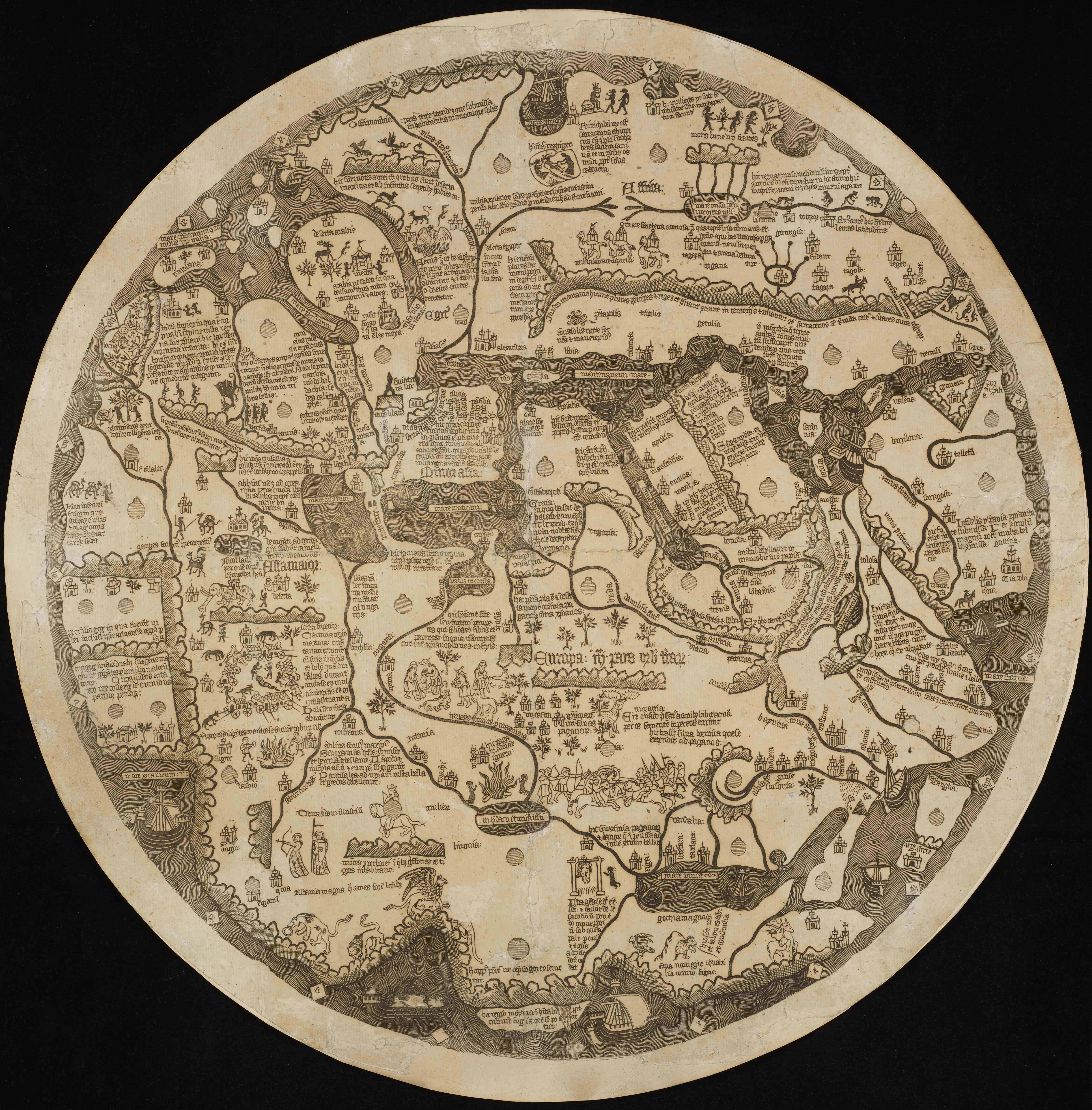
In addition to the monstrous races, examples of which are also found in the mappa mundi from the Liber chronicarum (Nuremberg Chronicle), the map also references a number of crusades. These include Charlemagne’s (748–814) invasion of Iberian territories, then occupied by Muslims, others in Africa, Nicopolis, and North-eastern Europe, and ‘infidel Spain subjected to Christianity by Charles the Great, after much fighting’. Unlike most maps from the period, in which foreign bodies feature along the edges, in the Borgia map the unfamiliar lurks everywhere. It depicts a Christian world under threat and expresses anxiety about and intolerance of non-Christian peoples. Considering that mappae mundi were typically oriented with east at the top, this map, with south at the top, pictures a topsy-turvy world.
The map’s emphasis on Christian history suggests it was made for a library or school. The script identifies the map as being made in southern Germany. A.E. Nordenskiöld believed that this map is a facsimile of one in cardinal Stefano Borgia’s (1731–1804) collection, where the map gets its name. Although it looks like a woodcut, it is actually an engraving. Nordenskiöld suggested that it was an impression taken by a goldsmith for the designing of an enamel or guilloche work and not intended to be a print and claimed that it may be the oldest surviving printed map. A detailed comparison with a known facsimile from the late eighteenth century held at the American Museum in Bath could provide answers to this conundrum.
Danielle Gravon, University of Manchester